Ride. Walk. Bike. St. Clair County Transit District
About Us
Delivering quality, reliable transportation choices every day.
Move through St. Clair County and beyond with us. View our programsStay Connected: Introducing SCCTD's New e-Newsletter
From overseeing the extension of the MetroLink alignment to MidAmerica St. Louis Airport and enhancing rider experiences through bus bench installations, to opening new trails as part of its ever-evolving MetroBikeLink System and helping to provide nearly 3.3 million transit trips per year –– St. Clair County Transit District (SCCTD) remains on the move. In …St. Clair County Transit District Board Approves Contract for Design of 1.4 Mile Trail in Swansea
The St. Clair County Transit District (SCCTD) Board of Trustees approved a $222,955 contract with TWM to design the 1.4-mile trail Frank Scott Parkway West Shared-use Trail in Swansea. This trail will connect into the SCCTD MetroBikeLink system at the Memorial MetroLink Station. Scope of services will include conceptual design, drainage and hydraulics, prefinal plans, …The St. Clair County Transit District has launched an interactive Bike Trail Map packed with helpful features, including bridge and tunnel locations, emergency call boxes, trail signage, parking information, and more. Whether you’re planning a ride or exploring new routes, this tool makes navigating the trails easier than ever!
Discover the Map Here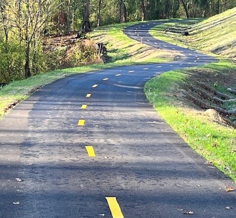
The St. Clair County Transit District (SCCTD) has been awarded $450,000 in Federal Transportation Alternatives Program (TAP) funds for the development of Phase 1 of its Fairview Heights-Swansea Trail. This new 0.25-mile connector trail segment will extend from Illinois 161 and Sullivan Drive/Union Hill Road north to the existing MetroBikeLink System of trails.
Find Out More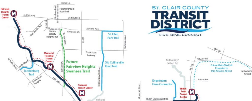
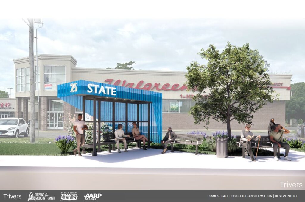
St. Clair County Transit District (SCCTD) is teaming up with Citizens for Modern Transit (CMT) and AARP in St. Louis to activate the space around the bus stop in the retail corridor of East St. Louis in front of Walgreens at 2510 State Street. Partners have released the initial design which includes an enhanced shelter, seating lighting, wayfinding, greenspace and more. Weigh in here!
Find Out More